Agricultural insurance is salient, particularly in agrarian societies, like China, where the economy is heavily dependant on its agricultural exports. Githaiga (2010) illustrates the importance of such schemes in nations like Kenya which is frequented by rampant fluctuations in weather conditions like ‘droughts, floods, hailstorms, excessive rainfall, frost, lightning, and landslides’. To add on to the perils, such industrializing nations rely on food production, not solely for increasing the export shares but for mere subsistence. Such exports play a pivotal role even in industrialized nations like the U.S, where food products still contribute to a substantial share of total exports produced.
Apart from diminishing the negative externalities produced by natural catastrophes, agricultural insurance is designed to provide additional relief by easing the access to greater lines of credit for rural farmers. Furthermore, it goes on to provide farmers with the unsaid benefit of awareness, by exposing farmers to the dangers natural calamities pose to their livelihood before they actually occur.
Despite being so beneficial, the scheme faces certain barriers with regard to how claims can be made.
Challenges
Agricultural/crop insurances are generally offered as either indemnity- based or index-based
Indemnity insurance places its focus on actual damage. It necessitates the assessment of the aftermath of a calamity and thus requires an individual insurer to visit farms to set-up coverage and assess losses. Such requisites make such a scheme extremely expensive and inefficient to assess remote smallholdings. Furthermore, it also opens the risk of adverse selection and moral hazard (IFAD, 2017).
In turn, Index based insurance is more secure. Instead of computing the compensation with the corresponding damage or actual losses, such schemes are indexed with ‘indirect indicators’ like lack of rainfall, snow level, landslide risk etc. Coverage in such schemes are computed using historical and real-time data. Hence it is more uniform in nature in the sense, all farmers in a particular area receive the same or a similar insurance product and therefore receive approximately the same payouts. In this insurance scheme, operational and administrative costs are greatly reduced; however, the installation costs of a data-collection system proves to be expensive. With limited access, availability, quantity, and quality of on-ground data of such indicators, this scheme too proves to be a far-fetched solution to the adversities natural catastrophes pose to farmers. (IFAD, 2017)
Solution
To address the difficulties that exist in ground-based data collection, the insurance industry had begun utilising satellite-based data either as a supplement to ground-based data or to create novel remote sensing insurance products. Remote sensors provide means to collect data based on specific ‘bio-physical’ variables like cloud temperature to estimate rainfall. These data accompanying other ground-based data are used to create indices. Hence within these parameters, the risk of loss or damage to crops can be assessed. If you’re keen to learn more about remote sensing and its various applications, please click here.
Furthermore, remote-sensing data archives are readily available, facilitating ease in making comparisons over time and in analysing trends. Remote sensing data are also gathered over large areas of space in a single unit of time and data collection frequently takes place; hence providing users with a more accurate, reliable and real-time set of data (IFAD, 2017)
Remote sensors used
Two main remote sensing systems are employed by various firms in need of geophysical data: Active sensors and Passive sensors.
Passive sensors make evaluations using sunlight reflected from the Earth’s surface and/or radiation emitted by the Earth’s surface. Such systems prove to be inefficient when there is cloud coverage over a particular area.
In contrast, active sensors are self-reliant and function independently from the Sun’s illumination. These systems employ their own source of energy (predominantly microwave and direct it towards the Earth’s surface. The amount of energy reflected back from the Earth’s surface then implicated certain data like the amount of moisture or the variability in the terrain. A notable example of an active sensor is the Radio detection and ranging or more popularly known as RADAR. This sensor emits its own microwave radiation and evaluated the amount of energy reflected back from the Earth’s surface to the sensor.
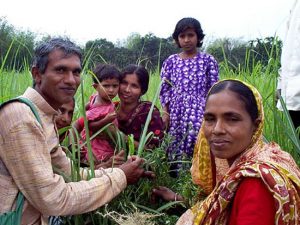
India – A Farmer’s Land
India’s crop insurance programme, launched 2 years ago, has seen a negative 6% growth rate for the current financial year ending. With less than 24% gross cropped area being insured this year (as opposed to 69% in China and a high 89% in the US), the crisis is clearly reflected by the rise in suicide rates amongst farmers. The target for the Pradhan Mantri Fasal Bima Yojani (PMFBY) programme for this fiscal year was 40% coverage; this has clearly failed.
Along with insurance programs being put into place, government authorities have to ensure the steady roll-out of subsidy from insurance agencies. According to ‘The Indian Express’, In 2017-2018, insurance companies have collected over 24,450 crore worth of premium receipts even after delays by states in forking out their subsidy contribution. The payouts to farmers this year have, however, totalled to a mere 402 crores. Crop loss assessment has to not only be timely but also reasonably accurate in order to improve confidence in farmers about the insurance schemes.
Conclusion
Raju and Chand (2007) describe that unexpected calamities are one of the many factors that inflate the number of farmers committing suicide which is now in ‘alarmingly high proportions’. Hence to prevent such adverse circumstances, agriculture/crop insurance should be made more accessible and readily available to both remote subsistence-farming societies and urban wholesale commercial farmers. Data collection for the former using ground-based data tends to be more difficult due to the lack of accessibility to such remote places.
In response to such issues, for the last 20 years, agricultural monitoring has been one of the central applications of ‘Earth Observation’ (IFAD, 2017). Although it was fairly employed more in the public sector, the importance of using remote-sensing data has been increasing within the private (insurance) sector as well. The data gathered from this technology coupled with more index-based insurance plans can serve more efficiently than indemnity insurances and/or ground-based data in computing coverages and assessing risk; hence providing farmers who face such extreme perils with a fair compensation and relief while at the same time effectively managing overhead and operational costs.
For more information on how remote sensing can benefit your industry, please contact us.