Infrastructure Monitoring Solutions
Monitor infrastructure remotely using Satellite Imagery
Monitor the progress of projects and infrastructure development remotely.
By combining Satellite Imagery, real-time field data and a management information system, SkyMap Global makes it easy and affordable to stay current on important projects of impact to your business.
How remote monitoring works
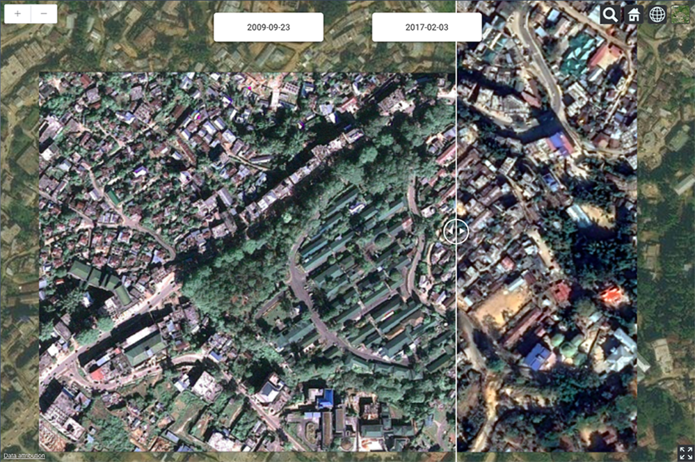
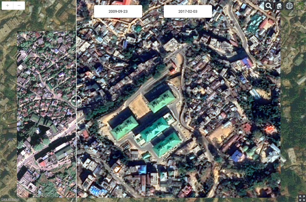
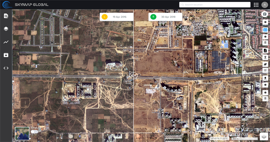
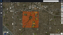
- Area of interest is captured via the satellite over a period of time.
- Project of interest is geo-tagged on a vector map.
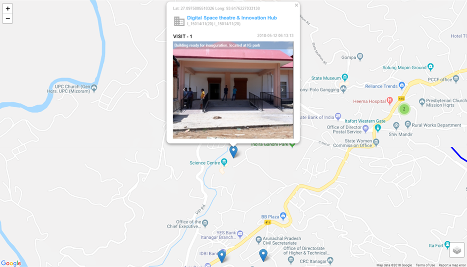
- Field personnel can travel to project sites to collect more pictures and information.
- Compare satellite and field images taken over time to understand change or progress.
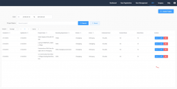
- The built-in management information system (MIS) is updated with material usage.
- A centralised dashboard collates all the above information for easy monitoring and response.
What's in the solution?
Geo-tagged Satellite Imagery
Satellites are tasked to capture images in your area of interest. Infrastructure projects inside your area of interest are marked on the map.
Android App
For your field-personnel to collect information or photos from the project site. Information collected in the field is updated on the dashboard in real-time. Information collected can also be customised to suit business requirements.
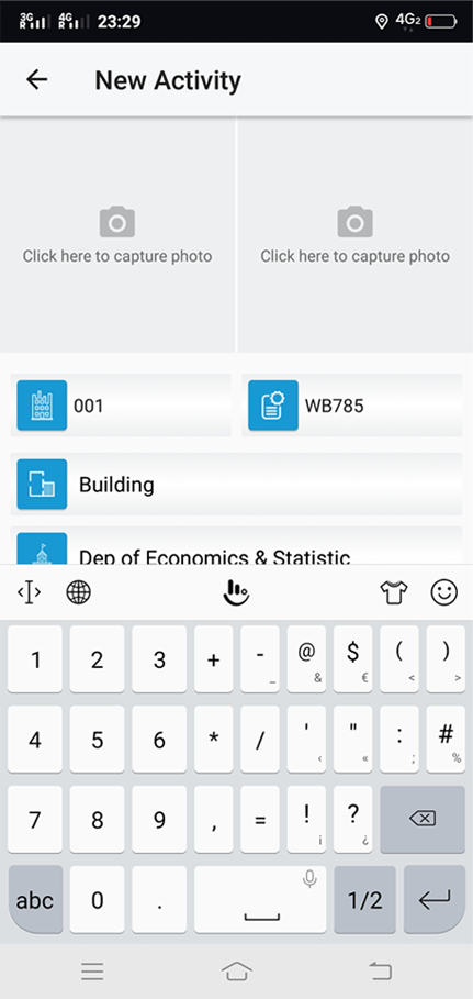

Management Information System (MIS)
The MIS helps track time and material for projects. The MIS can be updated either via the Smartphone app by the field personnel or via the web-app.
Advanced Infrastructure Monitoring
Get changes in infrastructure automatically delivered as a report at regular intervals.
Using machine learning, artificial intelligence and the power of cloud compute, SkyMap Global can help you:
- Get timely reports on changes detected and marked automatically
- Get insights into changes, built-up area, expansion, encroachment, etc.
- Plan resource and utilities allocation based on changes over time
- Make the right decisions affordably and efficiently
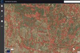
Building Footprint Extraction
Easily detect infrastructure and classify by building or project type from imagery. By employing advanced deep learning routines, we have automated the process of extracting 2D footprints with accurate geometrical edges.
Do away with outdated data and expensive data collection workflows for your application. Easily monitor projects and detect change for any region.
Automated Road Detection
Using the road detection algorithm, you can accurately
Case Study: See how the Government of Arunchal Pradesh is using the Infrastructure Monitoring Solution
In the Himalayan terrain of Arunachal Pradesh, traversing the land is arduous and time consuming. See how the government uses our Infrastructure Monitoring solution to stay on top of all projects, create transparency and eliminate unprofessional conduct.