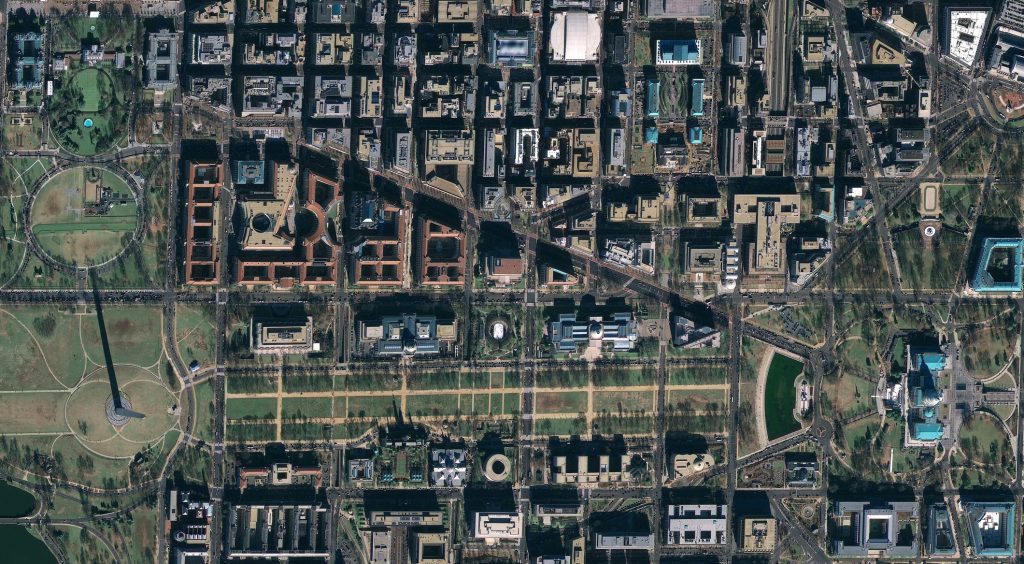
What is remote sensing?
Remote sensing, simply put, is the art and science of acquiring information about our Earth using remote instruments. These instruments do not require direct contact with the environment it is engaging with. We experience our lives through our five senses. Some of these senses (taste and touch), require direct contact with our sensory organs, while others (sight and hearing) do not. We are the perfect example of a Remote Sensor.
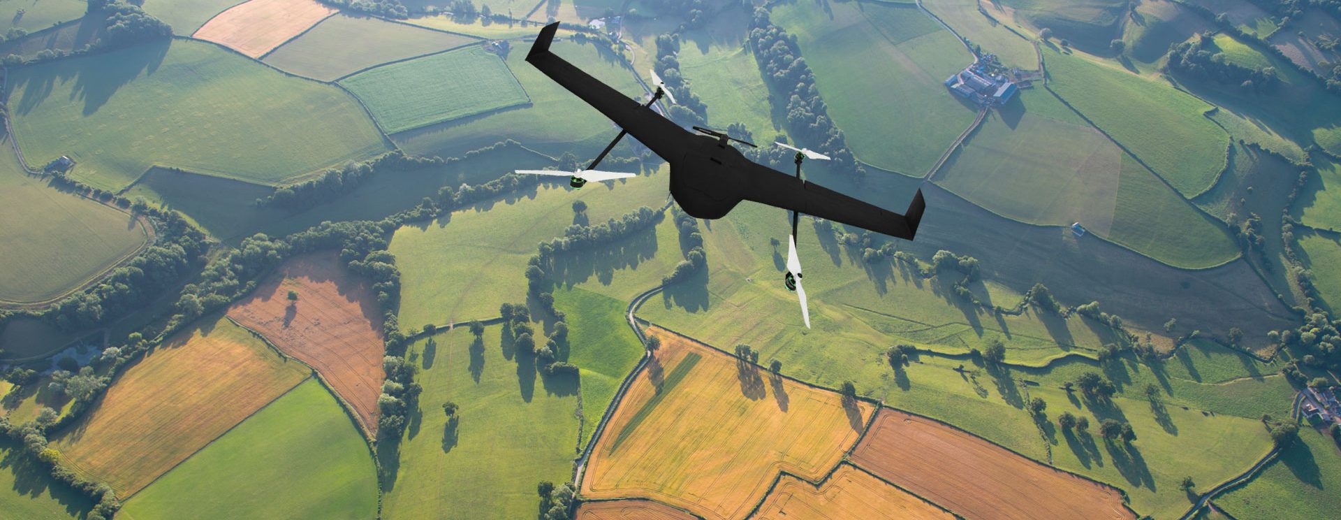
From Balloons to Drones
From cameras being attached to hot air balloons and pigeons, to launching Satellites and Drones, we have been able to capture the essence of change our Earth has witnessed throughout the years. As we are reeling under the pressure of climate change and disasters (along with many other emergency situations), revolutionary technology has stemmed from the quest to know more about Mother Nature.
The market is estimated to be USD 10.68 Billion in 2017 and projections calculate it to reach a grand USD 21.62 Billion by 2022. The increasing use of remote sensing services in commercial as well as defense applications is one of the most significant factors driving the growth of the remote sensing services market.
Why should we use remote sensing?
The IoT (Internet of Things) promises us an entirely new spectrum of data on all the things that we ‘own’. But what about all the things on Earth we do not own, like forest fires or even global oil supply? It is said that 80% of the world’s data has a spatial component to it. There are many reasons for wanting to collect information and data on the things we do not own, but ultimately it comes down to the desire to make smarter, better-informed and data-driven decisions. Effectively utilizing time with the help of better information will ultimately lead to greater business productivity.
Remote sensing helps us take a step back and view everything from space on a macroscopic point of view. Most remote sensing satellites cover the entire globe, making them a vital point in the study of world disasters and large-scale phenomena. Additionally, they can also be used cost-effectively for surveillance and monitoring remote or dangerous areas.
The constant coverage of the same area over long periods of time helps us monitor environmental change. The TripleSat Constellation comprises three identical electro-optical (EO) satellites – making it possible to target anywhere on Earth once per day. The maps obtained by satellite imagery are the basic tools for any developmental project, immensely helping the developing countries around the globe in various ways.
Some Applications of Remote Sensing
Natural Disasters
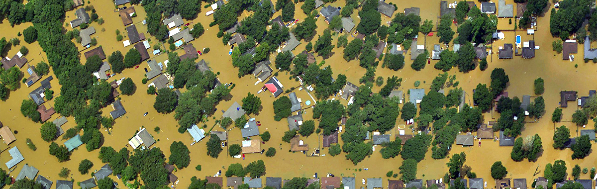
Satellite Imagery data can be obtained very quickly should there be a case of an emergency. This is especially important for an area during a natural disaster such as earthquakes, tornadoes, flooding or even forest fires. All the data collected from a sensor today is exactly the way it was collected yesterday. Meaning it is very consistent.
This makes it especially easy to detect even the most subtle of changes over a period of time. With the high frequency of images (produced every day), remote sensing could help save countless lives.
Counting cars in parking lots
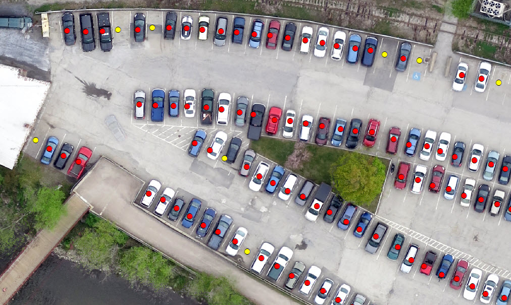
Trust me, it is not useless. Through the results of these test, market shares and retail earnings can be predicted. Companies can use these results to enhance predictive analytics by knowing what time consumers generally drive to their stores which would allow better resource management. This could also help estimate the revenue of stores.
“With a Satellite picture, you don’t have to guess based on what the manager is saying from a store or the opinion of a research analyst. It is a real piece of data you can look at” said Tom Diamond, co-founder of Remote Sensing Metrics.
Applications in agriculture
Agriculture plays a very important role in the economies of countries. The production of food in a cost-efficient manner is the goal of every farmer. Satellites have the ability to capture the images of individual fields and regions on a regular revisit cycle. Customers can then timely receive their field-based information for:
- Soil
- Soil erosion
- Soil moisture
- Mapping of soil type
- Compliance monitoring
- Mapping of soil management practices
- Vegetation
- Crop type classification
- Crop yield estimation
- Crop condition assessment
Using remote sensing tools such as satellite imagery or aerial imagery, this information stays up to date. Using today’s cloud technology, this information can be accessed at any time and be used to run analysis programs to get insights to drive a more cost-effective, resource-efficient agricultural process.
Pipeline monitoring
The oil and gas pipeline industry is one of the biggest in the world. Pipelines are crucial energy infrastructures which enable the transport of crude oil and gas through the distribution network. Well, Satellites help to monitor pipelines from space. This timely monitoring system will detect the leaks and even thieves. For pipeline operators, safety is paramount. Accidents tend to be serious enough to endanger many lives, destroy the environment and even cost millions of dollars!
Pipeline areas have to be constantly monitored and it is nearly impossible (as well as extremely costly and inefficient) for companies to physically check these areas.
Higher-resolution satellite imagery (<1m) can be deeply analyzed and any change can instantly be detected. Field operatives can then manually go down to these areas and take geo-tagged photos of any newly built features – the legal department will happily take care of the rest. Improving the oil and gas pipeline industry will help to drastically boost the performance of an economy and, in the bigger picture, ultimately benefit the country.
For a rapid (but yet much costlier) monitoring system, multiple sensors can be used. This can help detect even the smallest of changes of up to every 5 minutes. Did you know – It can take less than 15 minutes to fill a tanker? For the most efficient monitoring system this would be ideal, but ensuring daily remote sensing monitoring is also a really good start to faster-detected leakages and obstructions.
Urban planning
Urbanization is a rapid transformation of human social roots and their activities on a global scale. Village culture is being quickly replaced by the urban (city) culture. Throughout the world, urban development is happening on such a rapid scale that it demands a quick response and perspective physical planning of the cities and towns. Planning is a widely accepted way of handling problems of active decision making and resource allocation. It is a highly complex process aiming at a conceptualized accurate anticipation of future situations.
The market is now getting more inclined to using a more digital way of collecting and processing information. However, as remote sensing may not provide the in-depth information needed for a complete assessment, it would have to be integrated with some other spatial attributes. The combined analysis is performed through GIS techniques. Remote sensing techniques (along with its integration) can provide accurate and reliable information needed for planning and management of a city. These techniques are very useful for detecting changes in the current landscape, as well as the selection of sites for facilities such as hospitals, waste disposal, etc. Projects such as European Urban Atlas extensively use remotely sensed data.
A recent case study of GIS and Remote Sensing in urban transportation planning in Birkenhead, Auckland. This will help you understand the role of remote sensing on urban planning better along with giving you added information into the specifics of the process. The use of aerial sensor technologies to detect and classify objects on Earth (in the oceans and surface) through propagated signals such as electromagnetic radiation, make it possible to collect data on otherwise inaccessible areas. Remote sensing has revolutionized the way we can collect and analyze data.
While using remote sensing data does not require you to have an in-depth understanding of the entire process and how the technology works, having a working knowledge of just a few key concepts will help you attain a clearer picture as to what is feasible for you.
To learn more about how SkyMap Global can help you with remote sensing for your industry, send us a message.
good one
[…] Only after an efficient and effective flow of data has been achieved in a country can it hope to really boost its economic situation. India is still far behind the developed (and some developing) countries in leveraging remote sensing and geospatial capabilities. Geospatial capabilities can be applied in a wide variety of fields. For more information on remote sensing and its various use cases in a multitude of industries, please click here. […]
Dear Akash Mittal
I wonder is it possible to detect if any breaking of sanction like as Iran case using GIS or related devices or systems…if yes how it possible? I mean how can GIS or other systems understand there is an activity (flow) into pipeline in spite of ban.Thanks from now,
[…] operator or by a computer. Images captured by drones, or drone imagery, comes under the paradigm of remote sensing. Let’s take a look at how this state of the art technology affects us without our slightest […]