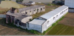
MINING
Our G-WING Vertical take off and landing drones does not need a large area of taking off and landing, which would be perfect for mining area mapping and monitoring. Have a look at some of the services we provide
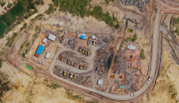
Survey with confidence and accuracy
Get access to accurate and reliable data of your mining area. With accurate surveying and mapping of your mining area, make informed and intelligent decisions. Get the data on your dashboard at a fraction of the cost.
Survey with confidence and accuracy
Get access to accurate and reliable data of your mining area. With accurate surveying and mapping of your mining area, make informed and intelligent decisions. Get the data on your dashboard at a fraction of the cost.
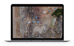
Reduce operational risk
With our drone surveying and mapping technology, eliminate the need for workers at high risk areas. Effectively map ut emergency routes and identify potential hazardous areas in advance to prevent accidents, overall creating a safer working environment
Reduce operational risk
With our drone surveying and mapping technology, eliminate the need for workers at high risk areas. Effectively map ut emergency routes and identify potential hazardous areas in advance to prevent accidents, overall creating a safer working environment
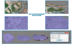
Gather accurate stockpile measurements and information
Our drones can be used to produce more accurate 3D stockpile models with accurate volumetric measurements data. Images can be used to gain more accurate decisions and speed up the job process. This gives less room for error in the reporting, as compared to traditional on the ground measuring
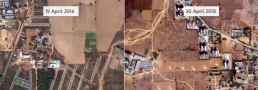
Project status with change detection
Understand the changes happening in your mining site with regularly updated basemaps. Using our automatic change detection tool, find out the changes over time. Respond quicker to changes emerging and track the progress of your project and ensure completion timings are met. Understand what has been done and what needs to be accomplished.
Ease of application process
By generating high resolution maps and 3D models/relity models of your site, you would be able to share the data with permitting authorities
Ease of application process
By generating high resolution maps and 3D models/relity models of your site, you would be able to share the data with permitting authorities
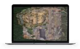
Land use change monitoring
Get land use change monitoring data on your whole mining site, visualise the changes and check for encroachment.
Land use change monitoring