Our research team in Vietnam led by Dr Thang Tran Ngoc has recently been successful in generating Automated Building Footprint from High-Resolution Satellite Imagery.
At SkyMap Global, we have been relentlessly working on developing and refining this solution using Deep learning Algorithms. We plan on launching this product for the commercial market by the end of this year.
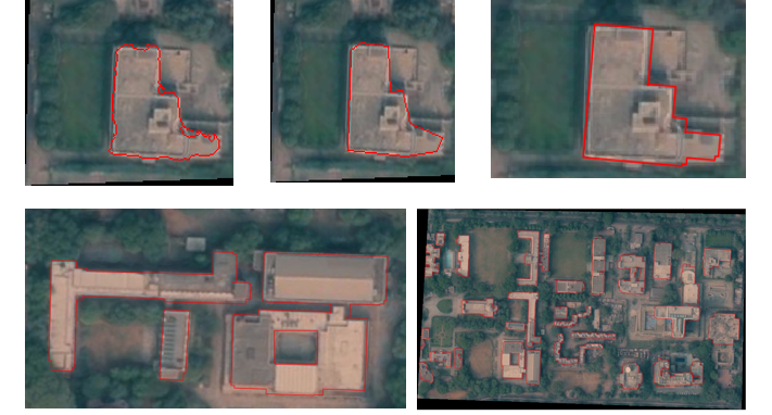
We are now in the process of testing the algorithms on data collected by Drones and other sources which provide much higher resolution. So far, the biggest challenge faced by the team has been to train the system, to extract building footprints, and to make the edges sharp.
The three stages of the development cycle have drastically improved the output from the low quality zagged lines to the sharp-edged footprints which are of far superior quality.
For more information on this, feel free to contact us.
How can I generate Automated Building Footprint from High-Resolution Satellite Image?