Curb Illegal Fishing
Illegal, Unregulated and Unreported (IUU) Fishing is a worldwide issue that threatens the marine ecosystem and sustainable fisheries.
Curb IUU Fishing
It violates conservation and management measures by over-exploiting the ocean’s resources. Hence, it is crucial that IUU Fishing is curbed. However, due to several factors such as the sheer size of the oceans, it has always been a challenge to detect these activities. This is where SkyMap Global can step in using MarineTrekk to detect ship related information.
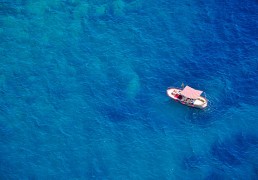
- Ship detection – Detection of individual vessels appeared in the newly acquired Synthetic Aperture Radar image.
- Ship location extraction – Extract vessels’ location in the geographical coordinate system by using the information of Satellite metadata and vessel location in the image.
- Ship information – Provide the vessel information such as: Size, heading direction
- Ship type identification – Ship type classification based on the extracted ship size.