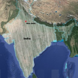
DIGITAL MAPPING
Create Digital maps Using AI/ML
Update and Generate the most current data on maps using Artificial intelligence and Machine Learning. Eradicate the labour intensive and time-consuming process of updating maps and generating Digital Maps.
Create Digital maps Using AI/ML
Update and Generate the most current data on maps using Artificial intelligence and Machine Learning. Eradicate the labour intensive and time-consuming process of updating maps and generating Digital Maps.
Basemaps
Get base maps for forest, Agriculture, Waterbody area etc.
Basemaps
Get base maps for forest, Agriculture, Waterbody area etc.
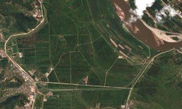
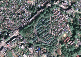
Agriculture and Forest Mapping
Map your agriculture and forest area to gain critical insights. Get crop health map, area estimation, damage estimation and irrigation channelling.
Agriculture and Forest Mapping
Map your agriculture and forest area to gain critical insights. Get crop health map, area estimation, damage estimation and irrigation channelling.
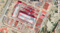
Project/Construction Mapping
Track and monitor the progress of your construction through timely surveying. Monitor the progress of your construction through imagery to check for new developments and or changes.
Monitor other unauthorized constructions around your area Geotagged data can be uploaded to get real time images to have as proof of construction progress.
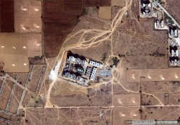
Project/Construction Mapping
Track and monitor the progress of your construction through timely surveying.
Monitor the progress of your construction through imagery to check for new developments and or changes.
Monitor other unauthorized constructions around your area Geotagged data can be uploaded to get real time images to have as proof of construction progress.
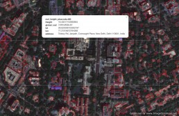
Land Surveying
Survey land to get key features, using our AI/ML algorithms, automatically detect features, visualise changes, and create basemaps to your needs.
Land Surveying
Survey land to get key features, using our AI/ML algorithms, automatically detect features, visualise changes, and create basemaps to your needs.
Inspections
Get volume inspections, pipeline inspection and thermal leaks information by surveying your area of interest
Inspections
Get volume inspections, pipeline inspection and thermal leaks information by surveying your area of interest
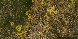
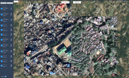
Urban change mapping
Monitor changes taking place by comparing time series images and maps to automatically detect urban growth and change.
Urban change mapping
Monitor changes taking place by comparing time series images and maps to automatically detect urban growth and change.
Get insights through AI/ML implementations
Using our in-house algorithms such as feature extraction, change detection etc, get critical insights from mapping your area of interest
Get insights through AI/ML implementations