In today’s day and age when we are collectively dealing with a multitude of issues ranging from resource use and conservation to terrorism, daily monitoring is a game changer. The information and dynamics captured through on a repeated daily basis literally lets us see how our ecosystem works and the way we impact it.
Whether it is required by an individual, businesses or governments; accurate, reliable and timely information is vital to effective decision making. In the absence of this information, people and organizations will make bad and inefficient decisions. The sad truth is – they cannot ascertain whether the decisions made were the best ones that could have been made at the time. Satellite and UAV based images are digital records that enable retrospective analysis, in turn leading to better and more accurate analysis.
The Essential Usage of Daily Monitoring – Examples
1. Human Rights Violation.
The following image shows the drastic impact the Islamist extremist group Boko Haram had in the Nigerian town of Baga.
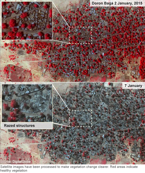
These images were released by Human Rights Watch (HRW) on 15 January 2015 show a clear act of arson and reports came through of an estimated 2,000 casualties after an attack by Boko Haram militants on the town of Baga. The damage is very clear. Amnesty International even described this as the terror group’s deadliest massacre.
2.Natural Disasters.
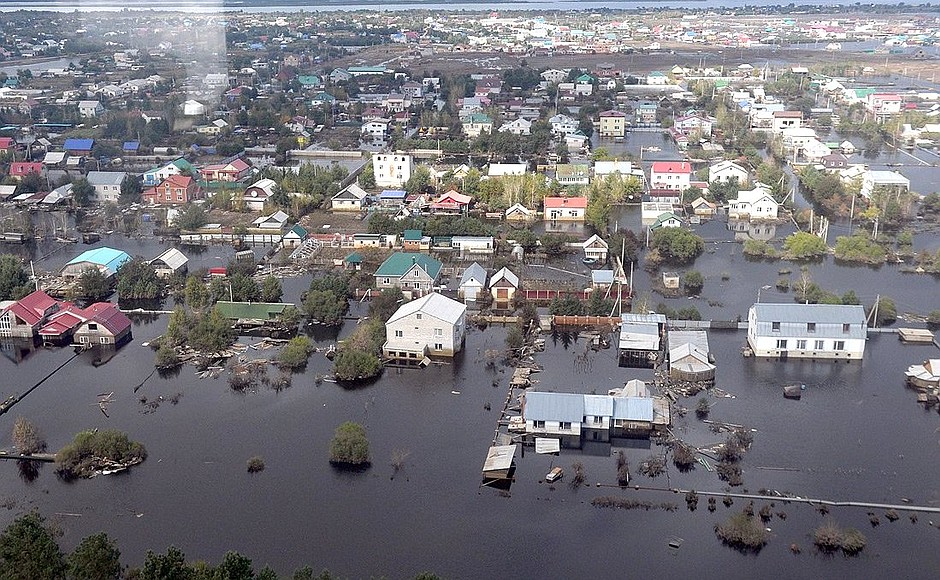
http://en.kremlin.ru/events/president/news/19096
Real-time monitoring data acquired from satellites provided information about the extent of flooding in Amur Russia in 2013, and its detailed analysis made it possible to successfully evacuate 2000 inhabitants of the affected areas. These images also greatly helped in assessing the extent of the damage that was caused by these floods. With these images, authorities were able to effectively plan a remedial action so as to prevent a further spread of the flood.
3. Migration
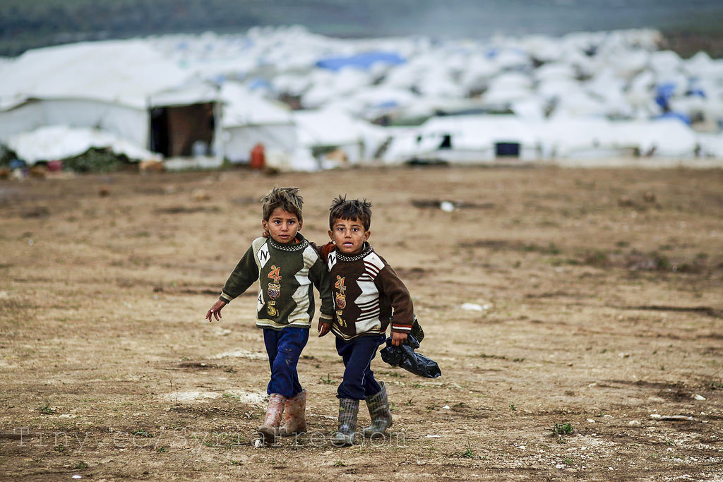
With Global conflict, terrorism and natural disasters, migration is a process often describing the large-scale movement of people from areas of hostility and instability to areas of safety and stability. An estimated 11 million Syrians have fled their homes since the outbreak of civil war in March 2011. About 1 million have requested asylum in the EU. Illegal migration is a huge issue in EU and the US. Authorities are installing fences to prevent migration across the borders but it is not very effective. In order to monitor mass migration, Satellite Imagery is required. If you want to help the Syrians on the ground, please click here to make your valuable donation.
4. Illegal Cropping.
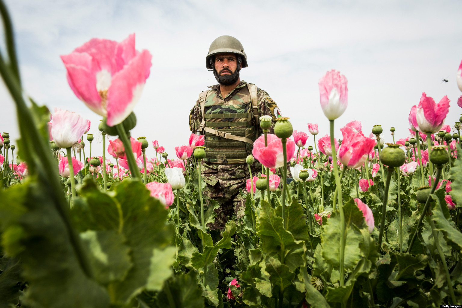
- KANDAHAR, AFGHANISTAN – APRIL 5: A soldier in the Afghan National Army’s 6th Kandak (battalion), 3rd company walks through a poppy field during a joint patrol with the U.S. Army’s 1st Battalion, 36th Infantry Regiment near Command Outpost Pa’in Kalay on April 5, 2013, in Kandahar Province, Maiwand District, Afghanistan. The United States military and its allies are in the midst of training and transitioning power to the Afghan National Security Forces in order to withdraw from the country by 2014. (Photo by Andrew Burton/Getty Images)
Drug traffickers often encourage farmers to grow opium or coca plantations. Multispectral and hyperspectral imagery can easily distinguish between different kinds of crops. According to the UNODC, in 2006, illicit cultivation of Opium poppy in Afghanistan provided nearly 92% of the total supply of opium to the world.
The monitoring and of illicit cropping is crucial in planning successful anti-narcotics activities. Spatial technologies such as remote sensing, GPS and GIS can help to provide the necessary information needed for successful action. Opium poppy crops have a relatively short cycle and are cultivated in small fields. With the help of drones, combined with many other necessary algorithms daily monitoring can help detect these plantations.
These are just some of the many uses of daily monitoring. There are literally countless applications where daily monitoring could prove useful. There are even different ways through which daily imagery monitoring can be taken – UAVs and Satellites. Each has its own set of strengths and weaknesses. Understanding how to best apply their strengths (and minimize their weaknesses) to fit your specific need will require a certain set of skills from a professional GIS-based company.
India – Daily Monitoring
In countries like India, where agriculture plays a vital role in the health of the economy, daily monitoring has the potential to greatly improve the economy. With UAV based higher resolution NVDI imagery, there can be a more timely assessment of crop health to provide immediate feedback to the farmers to take their now necessary well-informed action. This higher resolution UAV based imagery can help in earlier detection, diagnosis and even continuous monitoring.
India has recognized the importance of daily monitoring, ISRO (Indian Space Research Organization) will start to monitor suspicious vessels and boats venturing into the sea using satellite imagery as part of the establishment of the country’s coastal security.
Following the 26/11 Mumbai terror, India has been taking strong measures to prevent terrorist attacks.
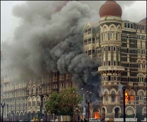
Daily monitoring is vital for the safety and welfare of any country too. With daily monitoring GIS capabilities, rural and various unreachable areas can also be tracked more frequently. Terrorists and paramilitary organizations usually set up camp at less known locations (such as deserts, coastal regions). With more frequent remote sensing tracking of these areas, the government will be better equipped to thwart these attacks.
A very well written article thoroughly educating me on daily monitoring. Kudos.
Hey Bijay, thanks!
[…] The combined use of satellite imagery and VMS would prove more useful than just the use of VMS alone. The VMS could focus on participating vessels, while satellite imagery could help in the detection of the unidentified vessels. The most effective method would be the use of synthetic aperture radar (SAR) for detection, optical imagery for high-resolution recognition and the correlation of data with VMS. Many rogue fishers turn off their radios before they enter restricted areas and this can be captured through satellite imagery, through daily monitoring. If you’re keen to understand more about daily monitoring and its various use cases in a multitude of industries, please click here. […]
[…] Through the use of remote sensing and GIS-based technology, forests can be monitored on a daily basis. If you’re interested in reading more about the power of daily monitoring, please click here. […]