skymap-global-logo-white
  • Products
    • SATELLITE DATA
      • DIGITAL ELEVATION MODEL
      • MAPPING & SURVEYING
        • DIGITAL MAPPING
    • BASEMAPS
    • MONITORING SERVICES
      • CHANGE DETECTION
    • API SERVICES
    • AI/ML SERVICES
    • DATA MANAGEMENT
  • USE CASES
    • OBJECT DETECTION
    • AGRICULTURE
    • URBAN TECH
    • FORESTRY
    • MINING
    • INFRASTRUCTURE MANAGEMENT
  • ONLINE DEMO SOLUTIONS
    • GREEN COVER DASHBOARD
    • FOREST FIRE DASHBOARD
    • MINING DASHBOARD
    • URBAN MONITORING
    • GEO-AI SOLUTIONS
  • Resources
  • BLOG
  • CAREERS
  • Contact us
  • Search

satellite imagery applications

May 11, 2018

Disaster Management using Remote Sensing technology


by Akash Mittal

March 23, 2018

Remote Sensing – Oil and Gas Pipeline Monitoring


by Akash Mittal

March 19, 2018

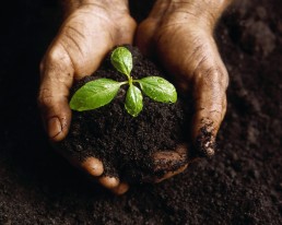
Remote Sensing – Soil Moisture Measurement & Applications


by Akash Mittal

skymap-global-logo-white

Catalyse the Geospatial domain by providing innov

COMPANY

Home
About Us
Careers
Industries
Solutions
Services
Events

INDUSTRIES

Agriculture
Forestry
Infrastructure
Marine
Government
Smart City
Surveillance
Retail

SIGN UP FOR UPDATES

ABOUT SKYMAP GLOBAL

Skymap Global is one of Asia’s leading Earth Observation Analytics company with a vision to leverage data for everyday use. We bring life to data through innovation by research. By connecting minds across borders and cultures, fostering talent and with our advanced knowledge centres, we create products of the future.

© 2018 Skymap Global. All rights reserved.