? sales@skymapglobal.com
Google Maps API Industry Use Cases
? Book free consultation call
We are a premier partner for Google Maps in South East Asia and India. We’ve successfully helped thousands of companies with licensing Google Maps for their applications.
Speak to our Certified Google Maps Consultants to learn how you can fully utilise Google Maps API in your platform.
See how businesses are using Google Maps API

XOOCAR
See how XOOCAR focuses on providing affordable, reliable, and comfortable rides to commuters by harnessing data, location intelligence from Google Maps APIs.

Safetrax
See how Safetrax uses Google Maps API Enterprise version to power the next generation of commercial transportation by making it smarter and safer to travel.
Madras Cements
See how Madras Cements uses Google Maps to visualize business data and glean insights from reports, allowing them to pinpoint strategies for business growth.
DPD introduced Google Maps APIs to power its drop-off location finder and now uses the APIs to introduce a new service: live tracking for deliveries. This tracking feature is one of the most-used services on the DPD website and unique in the German delivery market. Both the package sender and recipient can look up the exact position of the package and follow its location on the online map. They can also see the arrival estimate, accurate within 30 minutes, and redirect the package if needed. The live-tracking display allows the user to follow the route of their delivery live on a PC or smartphone at any time.
After considering a range of options, Allianz selected Google Maps APIs because of their familiarity, reliability accuracy, ongoing innovation and relationships with other data providers. The new interface lets employees easily pinpoint a member’s location and the nearest service providers. Additional data layers let them quickly see addresses, available services, distance and travel time, and traffic information, while Street View lets them see the exact location of an incident so the can better reassure their customers.
Sample use-cases with Google Maps API
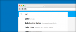
Address autocomplete
The Google Places API with Autocomplete can significantly streamline and simplify address entry in your application, leading to higher conversion rates and a frictionless checkout experience for your customers.
Improve app experience
Get local data and improve your customer experience using Autocomplete with the Places API.
Store conversions
Convert online searches to in-store purchases with a map-based store locator.
Travel & stay planning
Create the most convenient travel planner by leveraging up to date global data from Google maps.
Field force management
Optimise field force management using rich location data, tracking and visualise more information such as sales conversions on Google Maps.
Improved transport app experience
Map GPS coordinates to the geometry of the road and determine speed limits with the Roads API.
Asset tracking
Implement customisable, mobile-ready, scalable asset tracking applications.
Location discovery
Find a location based on information from cell towers and WiFi nodes with the Geolocation API.
Speak to our certified consultant
See how you can leverage Google Maps APIs in your app or project