3D city models are no longer just the ‘nice to have’ side projects governments keep to attract attention in the rich and exotic cities. They have become a necessity. With the increase in global warming and industrialization, the planning of every detail in a city becomes of utmost importance.
3D City Modelling and Virtual Designs
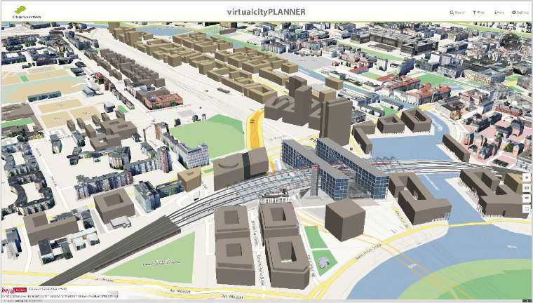
An urban 3D image is, in simple terms, a digital model of an urban environment with a three-dimensional geometry of common urban projects, terrain surfaces, vegetation, and structures as well as related objects belonging to urban areas.
Such 3D city models are used for planning, environmental analysis, the transportation sector, risk management and even visualizations of proposed new developments.
Sustainable development for cities is the emerging paradigm where state of the art technologies will drive to foster the development. 3D city Modelling combined with IoT, AI Cloud, and Big Data Analytics is actively paving the road for more sustainable cities.
The provision of aspirations for a better lifestyle, healthcare, education and the never-ending opportunities people are demanding is a growing challenge for any city. The imbalances in access to basic amenities between the different strata in society further increase due to its improper planning and forecasts.
3D city models are no longer just the ‘nice to have’ side projects governments keep to attract attention in the rich and exotic cities. They have become a necessity. With the increase in global warming and industrialization, the planning of every detail in a city becomes of utmost importance.
From the installation of photovoltaic panels (it produces electricity from solar energy directly) on rooftops to the determination of floor space and the valuation of buildings, 3D city modelling provides the platform for virtual city design models to be carefully analyzed and worked upon to derive the best and latest possible solutions.
Applications of 3D City Modelling by countries worldwide
Singapore
Singapore authorities are creating 3D maps of the entire country to help its organizations, both in the public and private sector, make better planning decisions.
Singapore’s long-term goal of optimizing the use of its limited land led it to ultimately turn to accurate ‘real world’ visualizations of the island.
According to the Singapore Land Authority (SLA), “Singapore Land Authority is committed to pushing Geospatial and technological boundaries to propel Singapore towards a Smart Nation. We are leading the development of Singapore’s 3D mapping initiative, which would form a key component of Virtual Singapore.” The SLA found the traditional 2D town planning maps to be highly inadequate as it couldn’t properly or completely represent the complex environment.
Modelling in 3D provides the city with a strong communication tool as it allows anyone to realistically view, in full scale, the potential impact of any proposed construction from multiple viewpoints and angles. Unlike a 2D image, a 3D image can be rotated to show impact from any perspective. This will aid potential stakeholders, businesses and most importantly residents, in understanding the complete impact the project can have on the environment and the economy of the city/state.
Netherlands
The Netherlands has used 3D city modelling for population estimation in a country-wide study. Geostatistical techniques are often used to estimate a country/nation’s population in the absence of reliable consensus data. With the advancement of remote sensing technologies – such as aerial photogrammetry, it is now possible to have an automated measure of a building which can then be used to accurately display the data as a volumetric representation (3D city model).
Urban areas are replete with a variety of geospatial information. This spatial information can be split into two very different, yet connected forms of information – virtual information and physical information:
- Virtual Information – Administrative boundaries such as city boundaries, jurisdiction boundaries of various government departments and even electoral districts.
- Physical Information – Includes communication networks, utility networks, hydrographic networks, transportation networks, etc.
The collection and making sense of all this data is essential to the local government. Allowing proper and full-fledged analysis of information, 3D city viewing is rapidly gaining acceptance. So what are the applications of 3D city modelling? Well, it ranges from anywhere; starting from the urban heat wave analysis to the citing of tower locations of cell phone companies to disaster management.
Germany
Berlin plays a major role in the digital economy throughout Europe and 3D mapping it could not only provide the government with data to plan infrastructure but also allow it’s citizens, businesses and other bodies to plan, simulate and build applications.
Berlin’s 3D city model is a joint project of the country’s Senate Department for Economics, Energy and Public Enterprises with the Berlin Partner for Business and Technology.
Around 550,000 buildings were photographed from the air and measured in order to create the model. This 3D City Model was initiated as part of the Berlin 3D city model project. The Berlin 3D city model is, to the best of our knowledge, the very first all-inclusive city model in CityGML format globally.
The open data model allows users to refer to the original CityGML data for sections of the city also for their own purposes (Game developers, city planners, architects, scientists, etc.)
The 3D City Model and it’s video material available for unrestricted use. Access it here.
You will be able to find pre-assembled data sets for each of the Berlin districts in the download which will help you comprehend more efficiently.
Some Applications of 3D City Models
-
Spatial Database Infrastructure Applications
3D city models are the perfect tools for governmental organizations. They are part of the spatial database infrastructure of the region. Site suitability analysis of thermal emission analysis of buildings and rooftop solar panel installations are some of the many developmental activities which will help build a sustainable future for any city.
-
Master Planning Applications
3D city models can immensely help planners from the conceptual development stage to the completion and long-term socio-environmental impact assessment stages.
3D city models will most definitely reduce planning errors and limit potential losses, it will also provide a whole new spectrum of visualization capabilities which will also help monitor the illegal vertical growth of the city and prevent project delays.
-
Disaster Management Applications
3D city models are very helpful in providing near realistic effects of any disaster. It can virtually simulate any disaster (bombs, fire, flood, etc.) with great precision and prepare authorities for any potential losses. This will help administrators to carefully plan management of rescue and resource mobilization.
-
Underground Modelling
The exact location of existing underground utility infrastructures is usually poorly known and can be of serious risk for infrastructure and highway construction projects. 3D city models will play a key role in designs of sewerage channels, railway line routing, and other geo designs. An investment in the environment formed by the favorable infrastructure and well-developed urban functions is the guarantee of an accelerated growth of economic development and modernization.
-
Navigational applications
3D city modelling can help map out a realistic display of the city and its navigation infrastructure. Due to its ability to allow the administration view it from a very realistic point of view, it is gaining widespread acceptance as a tool for intelligent/smart transportation.
In conclusion
These are some of the applications of 3D city modelling, but that is not to say there aren’t many more. With the innovation in today’s market and the rise of technology, who knows what can come up tomorrow?
Click here to read an impressive study on the applications of 3D city modelling by researchers from 3D geoinformation, Delft University of Technology, Netherlands and Department of Geography, University of Zurich, Switzerland. Courtesy ISPRS International Journal of Geo-Information.
3DCityDB is a website that has demo models of a few cities that can be used for research and education. The database offers people a place to store, represent and manage 3D models on top of a standard spatial relational database.
Excellent ….. Amazing …. your web. You made some important points.
Thanks Alex! Appreciate the valuable Feedback.