Map your customer’s journey
While we all connect to our local surroundings in a unique way, Google Maps – a single platform driven by location capabilities, has made it possible for each one of us to experience this the way we want. This sophisticated platform covers 99% of the world. And guess what? More than 1 billion people use it actively each month! With around 25 million updates daily, your business can definitely count on accurate and real-time location information.
Google has thought bigger. Not only did they make this platform available to the masses, they allowed enterprises to utilize their information to view their business direction and strategy differently from their competitors. To get the complete overview of the Google Maps Platform, please click here.
Thoroughly understanding your consumers and their behavior is vital to the success of any well-functioning organization. For startups, In order to survive the initial “starting up” phase, management and staff have to consistently take very calculated measures. With the help of Google Maps APIs, you and the rest of your colleagues or employees can view, understand, and make accurate decisions about location-based information.
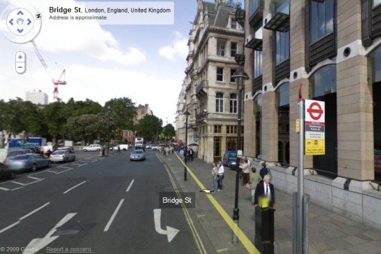
Another brilliant capability Google Maps APIs offers is Street View Image. Google Street View provides panoramic 360-degree views from designated roads throughout its coverage area. The list of currently supported cities for the street view is available here.
Here is an example of the Street View for a location in London, England –
Google Maps converges location-enabled analytics and customer engagement information to provide companies with a bird’s eye view of their company’s direction and results. This essential platform provides them access to a map database of the entire world, optimizing efficiency and eliminating the need for companies to go through the pain of creating their own database. Since start-up companies generally have very limited resources (most of these resources are focused on product development, sales, and marketing), appropriate allocation and efficiency of its resources are keys to its survival.
You can get all the benefits – All without investing in base map data.
The advent of Google Maps has led to the growth of new business segments, where location intelligence is what binds the various users and products. The integration of maps to their platform helped boost customer experience and usability of the application.
The success of several start-up tycoons such as Uber, Airbnb, and Ola can be attributed to the perfect execution of strategy as well as the involvement of information-dense maps at their core.
Google’s traffic and transit reach data are unparalleled.

Google is the most widely used mapping app and it has the biggest volume of sensors. I’d confidently say it is one of the most sophisticated applications I have used. These “sensors” I have just mentioned are, surprisingly, in fact, our smartphones. Our Androids that have location services turned on, and our iPhones that have Google Maps open, are actually sending anonymous bits of data to Google, which helps the company accurately determine how the traffic is flowing.
Explore worldwide map coverage with Google Maps APIs for businesses. Integration of this into your software and websites can help your company engage your customers with embedded interactive maps. Google Maps is ubiquitous in our daily lives. From the booking of hotels to the planning of vacations, this powerful platform empowers businesses and communities.
Google Maps can literally be used in almost every domain. For example, in the field of safety, Toyota Europe has developed an Android app to keep teen drivers safe. The app, Safe and Sound, uses the Google Maps Roads APIs and syncs with Spotify to promote safe driving. Click here to read more about how it works. Businesses all around the world are utilizing its data and integrating it with their ideas to create innovative solutions and apps. Huge business gains can be made by this simple implementation. Did you know that 80% of all data has a spatial component to it?
Augmented Reality
Just yesterday, on the 8th of May, Google showed off new features for Google Maps at I/O. This included an augmented reality Street View mode to help you follow directions in real time, along with personalized recommendations to help you explore new places in your neighborhood. The company has demonstrated the ability to use Augmented Reality in order to navigate around any given location by foot.
This new AR feature combines Google Maps’ existing Street View with Maps data. The live feed from your phone’s camera allows the overlay of information (walking directions) on top of the real world and helps you efficiently figure out which way you need to go. In its essence, when you hold up your phone, you’ll effectively see your directions floating ahead. Don’t worry the phone will know exactly which way you are facing by quickly doing a visual scan of your surroundings and matching many points of reference with those stored in its vast database.
Along with directions, this mode can also help identify nearby locations too. This feature will be featuring recommendations tailored specifically to you.
Google has not given an exact timescale on when Google Maps might get this feature, nor whether it will be an Android exclusive. But rest assured, it will come very soon. So stay tuned, we’ll keep you updated.
So, Why Google Maps?
-
Worldwide Data
-
Mobile Ready
-
Customizable Features
-
Developer Friendly
If you’re keen to find out more about use cases for Google Maps APIs for various industries, please click here. This will show you how different industries are harnessing the powerful capabilities of Google Maps APIs to drive their platforms to succeed. With the new pricing scheme of Google Maps, it is now much easier for companies of all sizes to get integrated with the Google Maps Platform. Click here to find out more about Google’s new pricing scheme.